Introduction
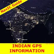
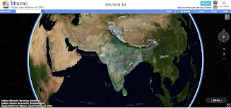
NavIC Indian GPS map app, also known as NavIC Indian Satellite, is a free app that provides information about India. It offers features such as a user-friendly interface, live satellite view map of India, and accurate navigation using the latest NavIC technology developed by ISRO. The app is useful for educational purposes, enhancing general knowledge about India, and aiding in various exams. It includes a 3D satellite imagery tool called Bhuvan, which provides highly detailed imagery of Indian locations. Another app called NavIC Guide also utilizes NavIC technology and offers detailed maps, turn-by-turn directions, and real-time location tracking. The app provides access to content from the official website of the Government of India and is not affiliated with or endorsed by any government authority. Users are advised to verify information directly from the Navic Bhuvan website.
The content highlights the following advantages of the NavIC Indian GPS map app:
- User-friendly interface: The app is easy to navigate and use, making it convenient for users.
- Live satellite view map of India: Users can access real-time satellite imagery of India, allowing them to explore the country's landmarks and locations.
- Live 3D and 2D maps of India: The app provides both 3D and 2D maps, offering different perspectives and enhancing the visual experience for users.
- Live map of India: With the NavIC Indian GPS map app, users can access accurate and reliable navigation services across India. The app utilizes the latest NavIC technology developed by the Indian Space Research Organization (ISRO) for real-time location tracking and navigation.
- Seamless navigation with turn-by-turn directions and voice-guided navigation: The app offers detailed navigation instructions, ensuring users can easily navigate through India while driving, walking, or cycling.
- Offline maps: Users can download maps for offline use, allowing them to navigate even without an internet connection. This feature is particularly useful in areas with limited or no internet access.
In addition to these advantages, the app also serves educational purposes by providing general knowledge about India and aiding in various exams. It includes a 3D satellite imagery tool called Bhuvan, offering highly detailed imagery of Indian locations. However, it is important to note that military installations in India are not included in the available images for security reasons.
- No virus
- No advertising
- User protection
Information
- File size: 11.00 M
- Language: English
- Latest Version: 1.1.9.3
- Requirements: Android
- Votes: 44
- Package ID: english733
Screenshots
Explore More
Explore the world with confidence using our intuitive map software. Navigate unfamiliar cities, find hidden gems, and plan adventures with ease. Our powerful apps feature robust offline functionality, real-time traffic updates, and crowd-sourced points of interest. Customize maps to match your needs - save favorite locations, download areas for offline access, and share recommendations.

BMP 2.0

TravelBoast

GameKeyboard +

English Bhagavad Gita

Air Navigation Pro

Watch Duty (Wildfire)

RoadStr

Kansas State Fair


