Introduction
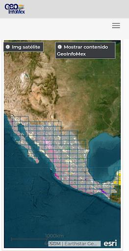
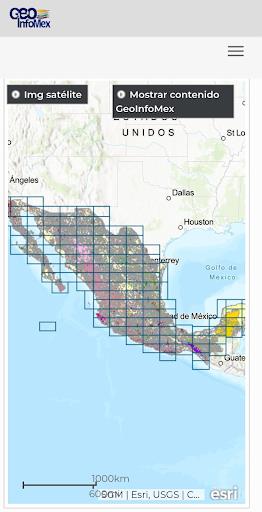
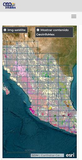
GeoInfoMex is a cutting-edge app that puts the entire Mexican Geological Service at your fingertips. This powerful consultation system allows you to access a wealth of geoscientific, geological-mining, and geophysical information about the Mexican Republic. With GeoInfoMex, you can easily explore geological-mining maps, discover information about mines, beneficiation plants, and sizable rocks. You can even access crucial data on agrarian nuclei, protected natural areas, earthquakes, and hydrological information among others. Whether you're a geology enthusiast, a professional in the field, or simply curious about the geological wonders of Mexico, it is the ultimate tool for you.
Features of GeoInfoMex:
> Comprehensive information: GeoInfoMex provides users with access to a wide range of geoscientific data, including geological-mining, geophysical, and geochemical mapping. This ensures that users have access to comprehensive and detailed information about the Mexican Republic.
> Mining information: Users can also find information about mines, beneficiation plants, and sizable rocks within the App. This feature is particularly useful for individuals who are interested in the mining industry or want to explore potential mining locations.
> Agrarian nuclei details: GeoInfoMex includes information about agrarian nuclei (ejidos) from the National Agrarian Registry. This feature is beneficial for users who are involved in agriculture or land management and need to access specific information about agrarian areas.
> Protected natural areas: The App also provides information about protected natural areas designated by CONANP. Users can easily find details about these areas and explore their ecological significance and conservation efforts.
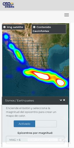
> Earthquake data: Users can stay informed about earthquakes in Mexico through this App. It utilizes information from reliable sources such as SSN and IG-UNAM to provide accurate and timely updates about seismic activities.
> Hydrological data: The app enables users to access hydrological information from Cencas, a reputable source for water-related data. This feature is crucial for individuals working in water resource management or those who need to monitor and analyze hydrological conditions.
Conclusion:
GeoInfoMex offers a wealth of geoscientific, geological-mining, and geophysical information about Mexico. Its diverse features, such as mining details, agrarian nuclei information, protected natural areas, earthquake data, and hydrological information, make it an essential tool for professionals, researchers, and individuals interested in exploring Mexico's geological and geoscientific landscape. Download the App now to access valuable and up-to-date information about Mexico's geological features.
- No virus
- No advertising
- User protection
Information
- File size: 2.95 M
- Language: English
- Latest Version: 3.1
- Requirements: Android
- Votes: 292
- Package ID: gim.pack
- Developer: Servicio Geológico Mexicano
Screenshots
Explore More
Explore the world with confidence using our intuitive map software. Navigate unfamiliar cities, find hidden gems, and plan adventures with ease. Our powerful apps feature robust offline functionality, real-time traffic updates, and crowd-sourced points of interest. Customize maps to match your needs - save favorite locations, download areas for offline access, and share recommendations.

BMP 2.0

TravelBoast

GameKeyboard +

English Bhagavad Gita

Air Navigation Pro

Watch Duty (Wildfire)

RoadStr

Kansas State Fair
You May Also Like
Comment
-
Esperamos que continuen desarrollando esta útil aplicación2024-05-03 09:33:31
-
Deberían actualizarla... además de colocar el nombre de cada corriente de agua. Está excelente que nos diga dónde se ubica, pero sería perfecto si nos facilitara su nombre.2024-05-02 08:43:36


