Introduction
Elevate your hunting game with the ultimate HuntStand: GPS Maps & Tools, boasting a completely redesigned interface for your scouting and navigation needs. With exclusive features such as nationwide property lines, whitetail activity forecasts, monthly satellite imagery updates, and group hunt area sharing, HuntStand is the go-to app for over 6 million hunters across North America. Keep track of deer movement, plan your hunts with precision using GPS mapping and HuntZone wind forecasting, and design detailed maps of your hunting areas. Download HuntStand now for free and experience the power of this award-winning app firsthand.
Features of HuntStand: GPS Maps & Tools:
* Nationwide Property Lines
Access private and public property boundaries and curated public land maps nationwide for all 50 states and most of Canada.
* Advanced Whitetail Forecasts
Exclusive 15-Day Whitetail Activity Forecast specific to your exact location. Know when to hunt.
* Monthly Satellite Imagery
View changes in your hunting ground with new satellite imagery delivered each month. Includes historical archive with years of imagery.
* Group Hunt Areas
Share hunt areas with buddies, lease partners, and family seamlessly.
* Nationwide Rut Map
The only county-level whitetail rut map with comprehensive rut dates, by phase, visualized through a color-coded system.
Tips for Users:
* Utilize GPS Mapping
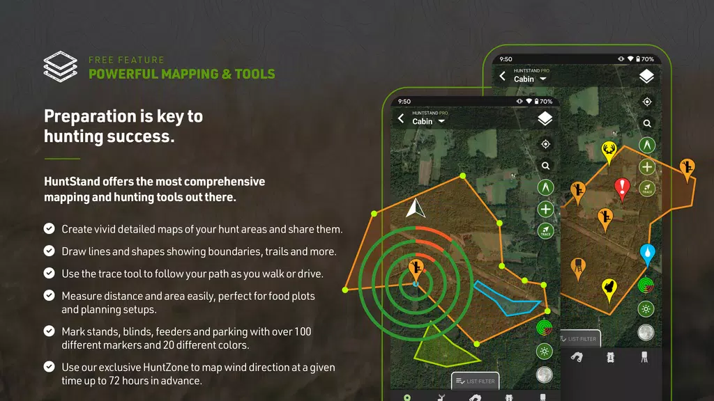
View your current position on the map and trace your path as you move in real-time. Add map markers to save important locations like tree stands.
* Plan with HuntZone Wind Forecasting
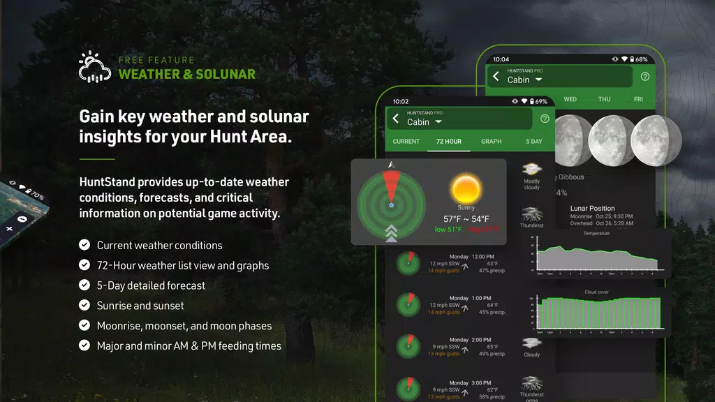
Map out your scent impact with HuntZone, providing hour-by-hour scent predictions for up to 72 hours in advance.
* Customize Hunt Areas
Design detailed maps of your hunting areas, tailored to your specific needs, and share them with hunting buddies, lease partners, and family members.
* Use High-Resolution Satellite Imagery
View detailed, high-resolution satellite imagery of your hunting areas to plan and navigate with precision.
Conclusion:
Enhance your hunting experience with HuntStand: GPS Maps & Tools. With essential features like nationwide property lines, advanced whitetail forecasts, and customizable hunt areas, HuntStand is the perfect tool for successful hunting seasons. Download the app now for free and start mapping your hunting areas with precision and ease. Experience the value and power of HuntStand today!
- No virus
- No advertising
- User protection
Information
- File size: 16.80 M
- Language: English
- Latest Version: 8.0.4
- Requirements: Android
- Votes: 499
- Package ID: com.huntstand.core
- Developer: TerraStride Inc.
Screenshots
Explore More
Equip yourself with our all-in-one toolbox app for everyday tasks and projects. Instantly convert between units, calculate tips, scan documents, manage files, and more with handy productivity tools. Includes a level, compass, QR code reader, ruler, speedometer, decibel meter, and flashlight. Save frequently used tools to your customizable dashboard for one-tap access. Track billable hours, wages, budgets, and invoices. Annotate screenshots, magnify labels, and sign PDFs on the go.

Trace and Draw Sketch Drawing

Future Self Face Aging Changer

Same Notification - Parental
GoldSeeker - Metal Detector
Voice Recorder, Voice Memos

Psychological concepts

Heyo

Kilid


