
Introduction
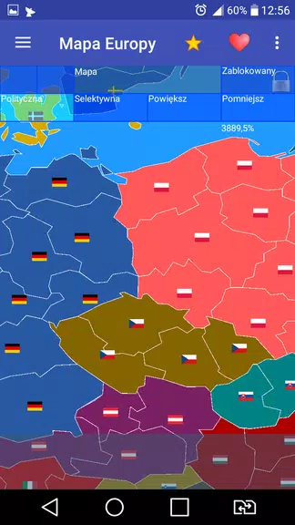
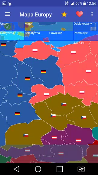
Europe map is a lightweight mapping app designed to help travelers, students, and professionals explore the European continent with clarity. It delivers detailed political boundaries, major cities, transport corridors, and points of interest in an intuitive layout, combining offline access and fast search for reliable navigation and planning.
Overview and purpose
Europe map targets users who need a focused, easy-to-use atlas of Europe without the clutter of global mapping platforms. It prioritizes readability and quick reference, making it suitable for trip planning, classroom use, or as a visual aid during research. The app emphasizes clarity over extra features, so core tasks complete faster.
Key tools and data included
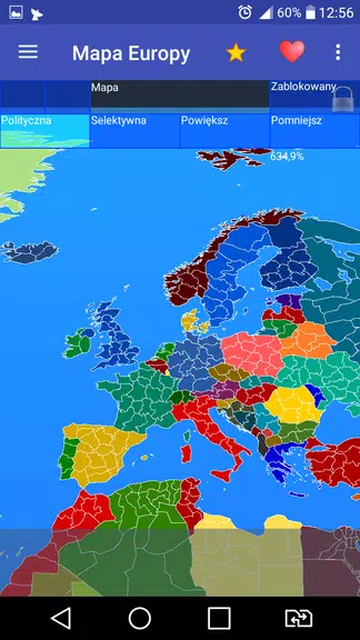
- Political boundaries: Clearly delineated country borders with administrative regions where available.
- Cities and towns: Major and secondary population centers searchable by name.
- Transport networks: Rail lines, major highways, and international ferry routes highlighted for route awareness.
- Points of interest: Landmarks, airports, ports, and protected natural areas marked for quick identification.
- Offline layers: Download regional map tiles to use without an internet connection.
How it works in daily use
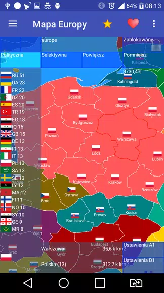
Europe map is built around straightforward interactions. Use the search bar to jump to a specific city, pinch to zoom between country and regional scales, and tap map symbols to view short descriptions. Offline downloads are organized by region, so you can save only the areas you need and conserve storage.
User interface and controls
The interface keeps controls minimal: a persistent search box, a layers button for toggling transport or POI overlays, and a download manager for offline content. Color contrast and typography were chosen for legibility at both zoomed-in and zoomed-out views, helping users spot borders and labels without strain.
Performance and resource usage
Performance is optimized for a wide range of devices. Map rendering uses vector-based tiles that scale smoothly and require less memory than large raster images. Tile caching reduces data usage on repeat views, and background downloads let you prepare maps while continuing other tasks.
Customization and map layers
Europe map offers several customization options to tailor the display: switch between political, physical, and transport-focused layers; adjust label density to reduce clutter at lower zoom levels; and toggle satellite imagery where higher-resolution visual context is helpful. These settings help users adapt the map to study, travel routing, or presentation needs.
Practical scenarios and workflows
For travelers, the app provides quick access to airport locations and major transit corridors to plan multi-country itineraries. Educators can use the app in class to illustrate regional geography and historical borders. Researchers benefit from the ability to export simple map snapshots for reports and presentations without extra graphic design work.
Tips for new users
- Download regions before travel: Save maps for offline use when crossing borders with limited connectivity.
- Use label density: Lower the label density when viewing multiple countries to keep the map readable.
- Pin important locations: Create quick-access pins for places you’ll reference often during a trip or project.
Support and updates
Regular updates refresh administrative boundaries and transport information as changes occur. The app includes a feedback channel for reporting data errors or suggesting new features, helping maintain accuracy for all users.
Why people choose this app
Users appreciate Europe map for its focused coverage, speed, and practical tools that streamline planning and learning. It doesn’t try to replace full-featured navigation systems; instead, it concentrates on continental-scale clarity and convenience, which many users find more useful for study and cross-border travel planning.
Getting started
Install the app, grant storage permissions for offline maps if you plan to use them, and run an initial region download for your primary area of interest. Spend a few minutes exploring layers and pins to configure the view to your preferences. With these steps you’ll be ready to use Europe map as a reliable reference on the go.
- No virus
- No advertising
- User protection
Information
- File size: 6.10 M
- Language: English
- Latest Version: 1.60.1
- Requirements: Android
- Votes: 133
- Package ID: eu.uvdb.game.europemap
- Developer: Cygnus Software
Screenshots
















Explore More
Experience nonstop thrills with our newest edge-of-your-seat action game! With console-quality graphics and intuitive touchscreen controls, you'll be drawn into high-octane combat and stunt-driven gameplay. Choose from an arsenal of upgradable weapons and vehicles to blaze through enemy bases, post-apocalyptic cities, and more. Physics-based action packed with explosions and destructible environments make every level more intense than the last.

Reboot Love (Part 2) (2.7.6) (NSFW +18)
Typing Master Word Typing Game

Piano - FNAF

Baby Panda's Bath Time

Pet Doctor

Unicorn Games for 2+ Year Olds

Gods Of Arena

Beat Live: Show Music Game