Introduction
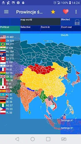
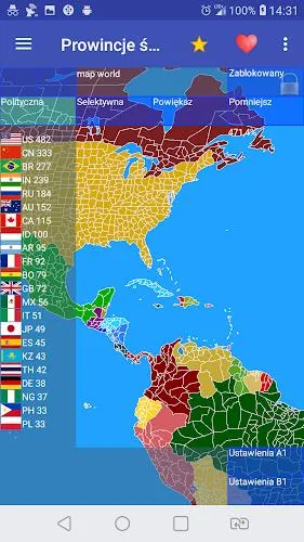
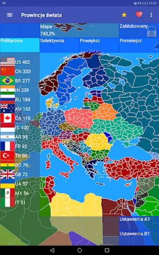
World Provinces is a comprehensive map and history sandbox that helps users design nations, redraw borders, and run large-scale historical simulations on a province-by-province world canvas. The app places more than 4,440 provinces and over 210 nations at your fingertips, letting players reconstruct historical powers, explore alternative timelines, or build entirely new political geographies for study, education, and presentation.
Key Features
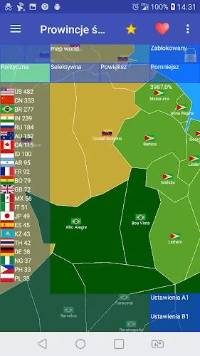
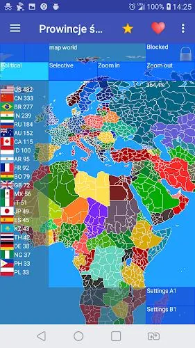
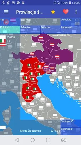
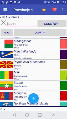
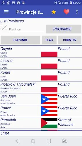
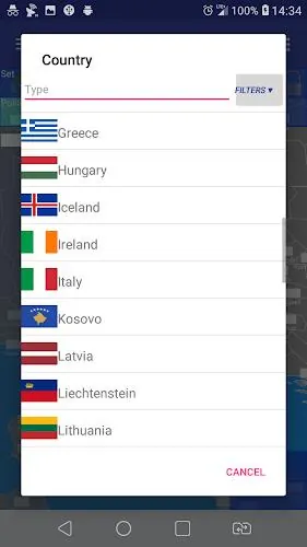
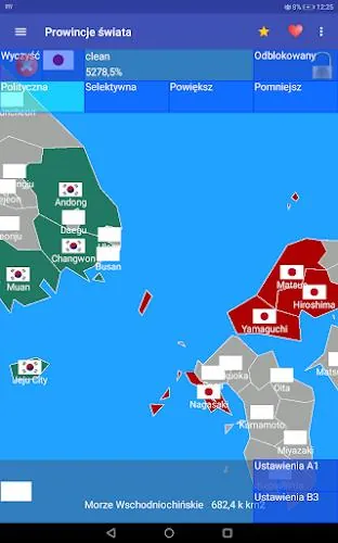
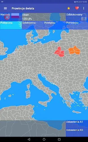
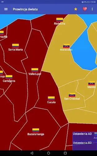
World Provinces combines a nation editor, flag and symbol creation, and multi-mode map manipulation into a single mobile-friendly toolkit. The nation editor lets you name states, define capitals, assign governance types and colors, and draw or auto-generate borders. The built-in flag and emblem editor supports layered symbols and simple color fills so every state can wear a distinct identity. Historical reconstruction tools provide templates and reference setups for major historical polities, while alternative history controls let you test 'what if' scenarios by shifting borders and leadership on demand. Multiple presentation modes — Strategy, Simulation, and Map Building — provide different balances between hands-on design and automated runs.
Gameplay and Mechanics
Gameplay in this sandbox is focused on creative map design and large-scale simulation rather than linear campaigns. You can operate at the macro level to manage entire nations and alliances, or zoom in to edit individual provinces and local symbols. Simulation mode includes adjustable speed and pause/step controls so you can observe how border changes propagate over time; strategy mode emphasizes planning and staged decisions; map building mode is optimized for precise editing and export-ready visuals. Scenario objectives are available for users who prefer goal-oriented sessions: optional challenges provide milestones such as unifying a region or stabilizing a multiethnic federation under specified constraints.
Controls and User Experience
The interface is tuned for touch and mouse input: tap-and-drag to draw borders, pinch-to-zoom for detail work, and long-press for context menus with province-level options. Editing tools include snapping to province grids and undo/redo history for safer experimentation. Tooltips and on-screen hints guide new users through common tasks while advanced options remain accessible for experienced creators. The app balances depth and approachability with layered tool complexity so users can start simple and progressively use more advanced features as they grow comfortable.
Progression, Challenges, and Replay Value
Although World Provinces is a sandbox rather than a linear progression game, it offers structured replayability through scenario packs and challenge maps. Progression can be self-directed: users set increasingly difficult objectives, refine map designs, and publish scenario files for others to import. Built-in difficulty toggles and scenario constraints let you create time-limited or resource-limited challenges for single-player experimentation. Because every playthrough is shaped by different border edits, governance choices, and historical starting points, the title encourages experimentation and repeated engagement.
Customization and Visual Style
The visual presentation leans toward clear, information-dense cartography: province boundaries, topo-aware coloring, administrative overlays, and crisp symbol rendering make maps readable at both continent and province scales. Customization extends beyond flags to include label styles, color palettes, and state iconography so produced maps suit educational slides, creative projects, or tabletop references. Export options let you save high-resolution map images and share scenario files for other users to import locally.
Accessibility, Offline Use, and Community Content
Accessibility options include adjustable UI scaling, readable font sizes, and colorblind-friendly palettes to help a broad range of users interact comfortably with detailed maps. Most editing and simulation functions work fully offline; you can save scenarios and export files locally without an online account. Community content is supported through importable scenario files and shared bundles that creators distribute via standard file-sharing methods, making it easy to try other people’s reconstructions and alternate histories while keeping the core app self-contained.
Advantages and Considerations
World Provinces offers powerful editing tools and a very large geographic scale that supports both sweeping strategy concepts and province-level detail, making it valuable for educators, hobby cartographers, and grand-strategy fans. The open-ended design and scenario import/export model foster creativity and long-term replay. Users should note that the depth and scale can present a learning curve; designing highly detailed scenarios may be time-consuming for casual sessions, so new users are encouraged to begin with templates and guided scenarios before attempting large custom reconstructions.
- No virus
- No advertising
- User protection
Information
- File size: 8.20 M
- Language: English
- Latest Version: 1.17.1
- Requirements: Android
- Votes: 101
- Package ID: eu.uvdb.game.worldprovinces
- Developer: Cygnus Software
Screenshots


Explore More
Unlock your greatest potential with our innovative education apps. From early learning to college prep, we offer tools for students of all ages. Young learners can build skills through interactive games and stories. Older students can strengthen expertise in math, science, writing, and more with our targeted training. Test prep students can access thousands of practice questions and simulations. Manage assignments, take notes, and stay organized with our productivity tools.
Fruits and Vegetables for Kids

Cultura y Turismo Qro

Success And Money Tracker

BF Pilates

Team Lally

l18: Test app update03

The Medrano Group

Michael St. Jean Realty