Introduction
Introducing the GPS Land Area Measurement App! This incredible tool is perfect for anyone needing to measure field area and distance with ease. Whether you're a farmer, land surveyor, or just curious about a plot of land, this app has got you covered. With the ability to convert different shapes of land into various units, such as feet, meters, and kilometers, you can accurately measure any area. Not only that, but you can also calculate the distance between multiple points to get a complete picture of the land. Plus, you can even find nearby places to explore. Download the app now and start measuring and exploring like never before! Don't forget to give us your feedback and suggestions – we're always here to help make the app even better.
Features of GPS Land Area Measurement App:
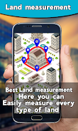
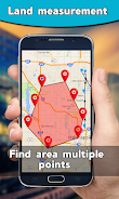
- Area measurement and land surveying: The app allows users to accurately measure the area of fields, farms, and plots using GPS and maps. It eliminates the need for manual measurements and provides precise results.
- Distance meter: Users can measure the distance between different points on the map by marking at least two or multiple locations. The app automatically calculates and displays the distance on the screen.
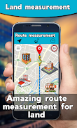
- Route finder: With the app's route finder feature, users can find the best route to reach their desired destination. It provides directions through a compass and helps users navigate their way efficiently.
- Nearby places search: Users can easily find nearby places such as airports, ATMs, banks, hospitals, restaurants, and more. The app includes a distance finder to determine the distance between the user's current location and the desired place.
- Unit converter: The app offers a unit converter that enables users to convert land and distance measurements into various units, including feet, square feet, meters, square meters, kilometers, miles, square miles, and square yards.
- Live Earth Map: The app provides users with access to live earth maps in normal, hybrid, and satellite views. This feature allows users to visually explore different areas and gain a better understanding of their surroundings.
Conclusion:
With the GPS Land Area Measurement App, measuring and calculating land areas and distances becomes effortless. The app's accurate GPS technology and user-friendly interface make it a valuable tool for those working in fields, farms, and land areas. The route finder and nearby places search features enhance convenience and efficiency. Additionally, the unit converter and live earth map provide comprehensive measurement options and visual exploration capabilities. Download the app now to simplify your land measurements and enhance your navigation experience.
- No virus
- No advertising
- User protection
Information
- File size: 7.65 M
- Language: English
- Latest Version: 1.0.8
- Requirements: Android
- Votes: 304
- Package ID: com.appsmi.land.measure.area.calculator.navigation.traffic
Screenshots
Explore More
Explore the world with confidence using our intuitive map software. Navigate unfamiliar cities, find hidden gems, and plan adventures with ease. Our powerful apps feature robust offline functionality, real-time traffic updates, and crowd-sourced points of interest. Customize maps to match your needs - save favorite locations, download areas for offline access, and share recommendations.

TravelBoast
GameKeyboard +

English Bhagavad Gita

Air Navigation Pro

Watch Duty (Wildfire)

RoadStr

Kansas State Fair

WHIO Weather


