Introduction
Karttaselain is a mobile mapping app that brings free topographic maps, aerial imagery and basic property and depth data into a single offline-capable toolkit. Designed for hikers, boaters, landowners and anyone who needs reliable location data, Karttaselain combines the National Land Survey's up-to-date topographic maps with urban plans, aerial photos covering Finland and a Norwegian topographic layer for cross-border outings. The app pairs precise GPS positioning, route import/export and map feedback tools with an optional Plus subscription that unlocks deeper marine charts, continuously updated property records and advanced offline and syncing capabilities.
Core Functions
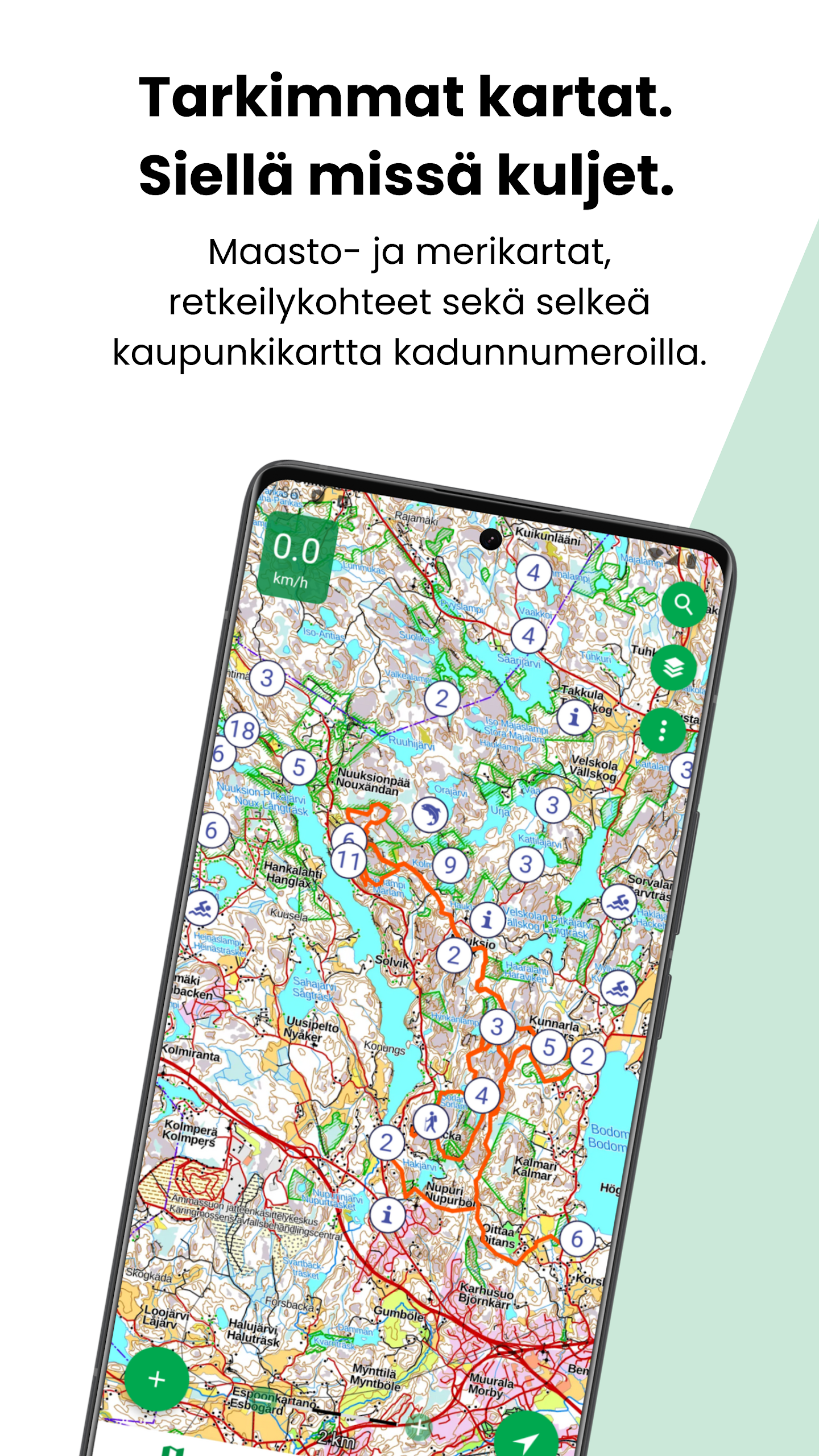
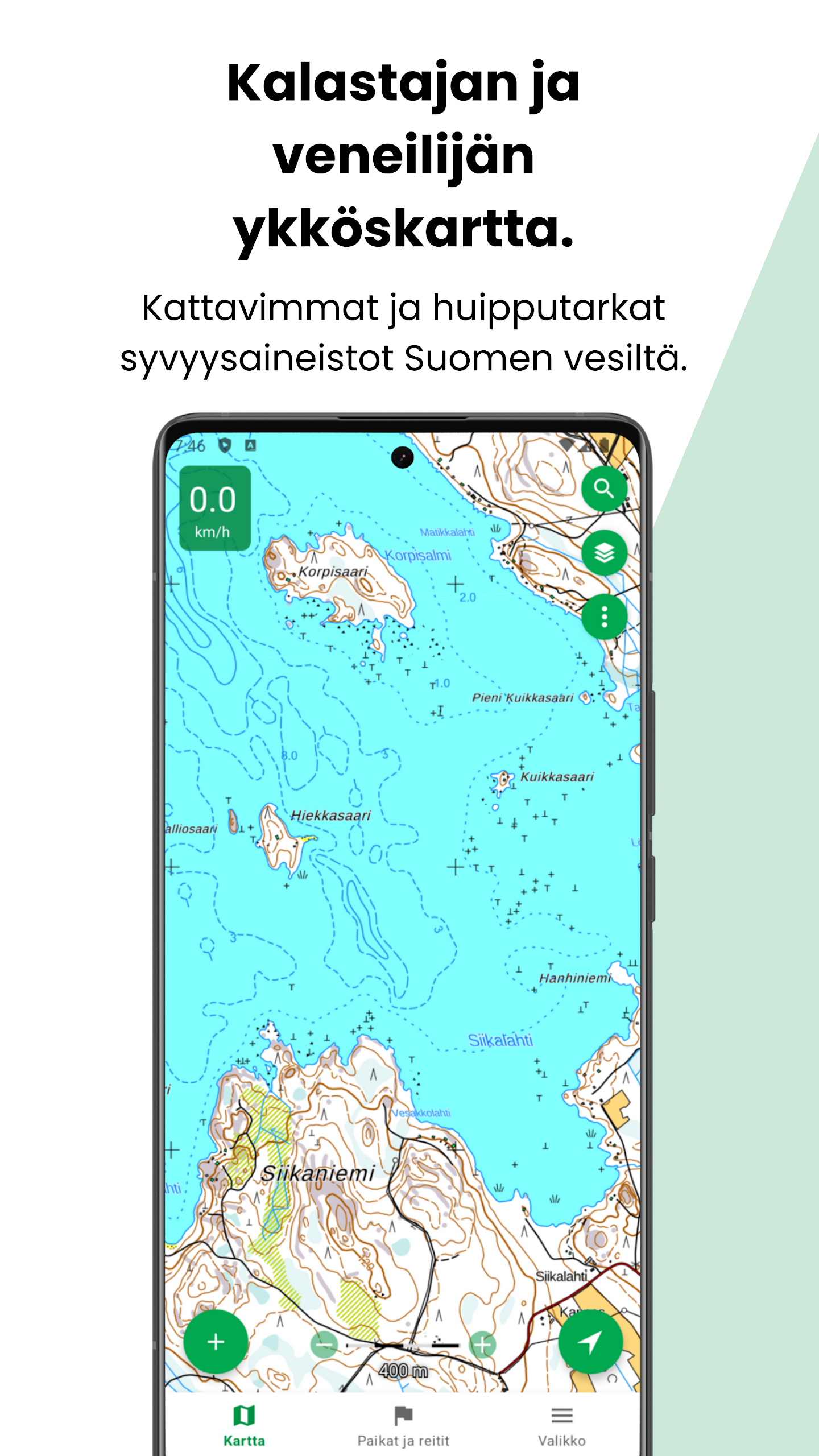
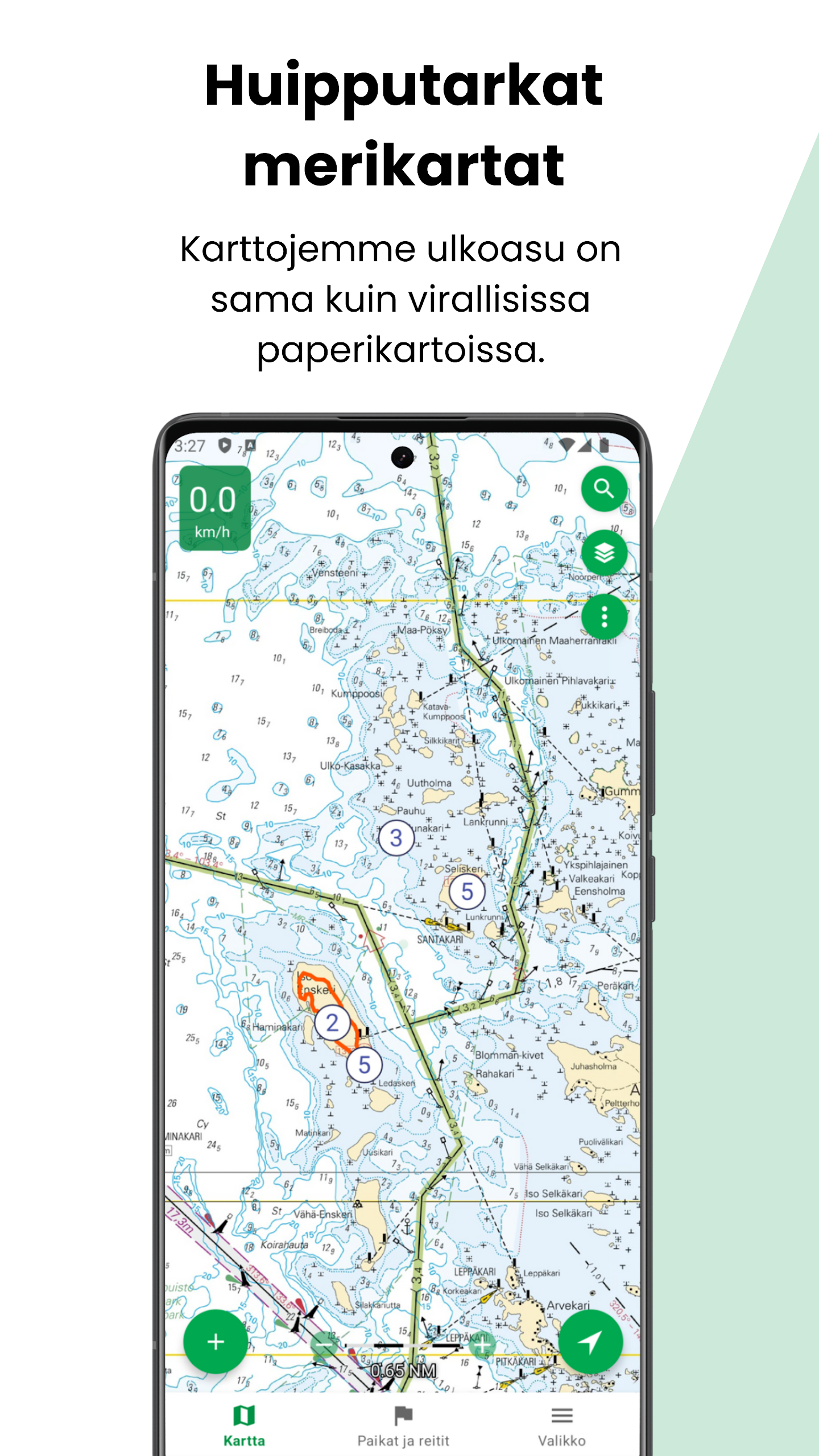
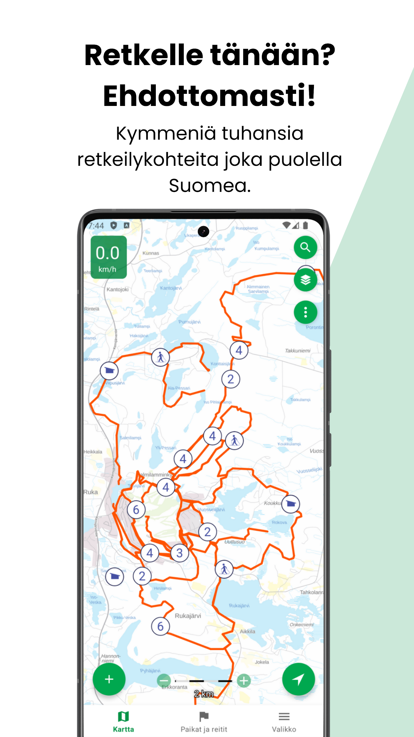
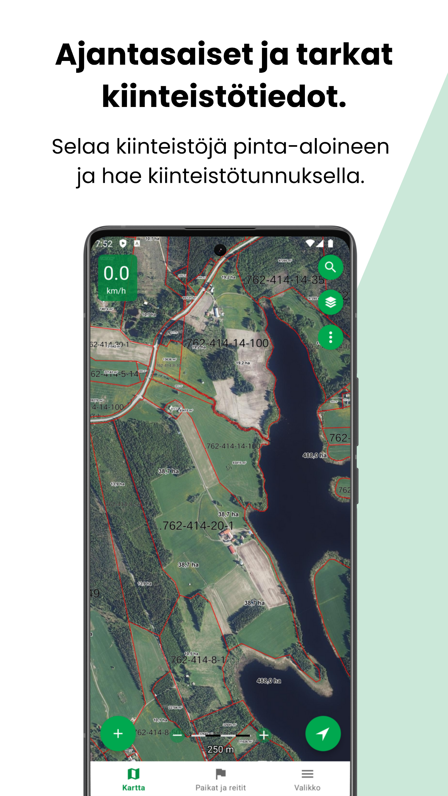
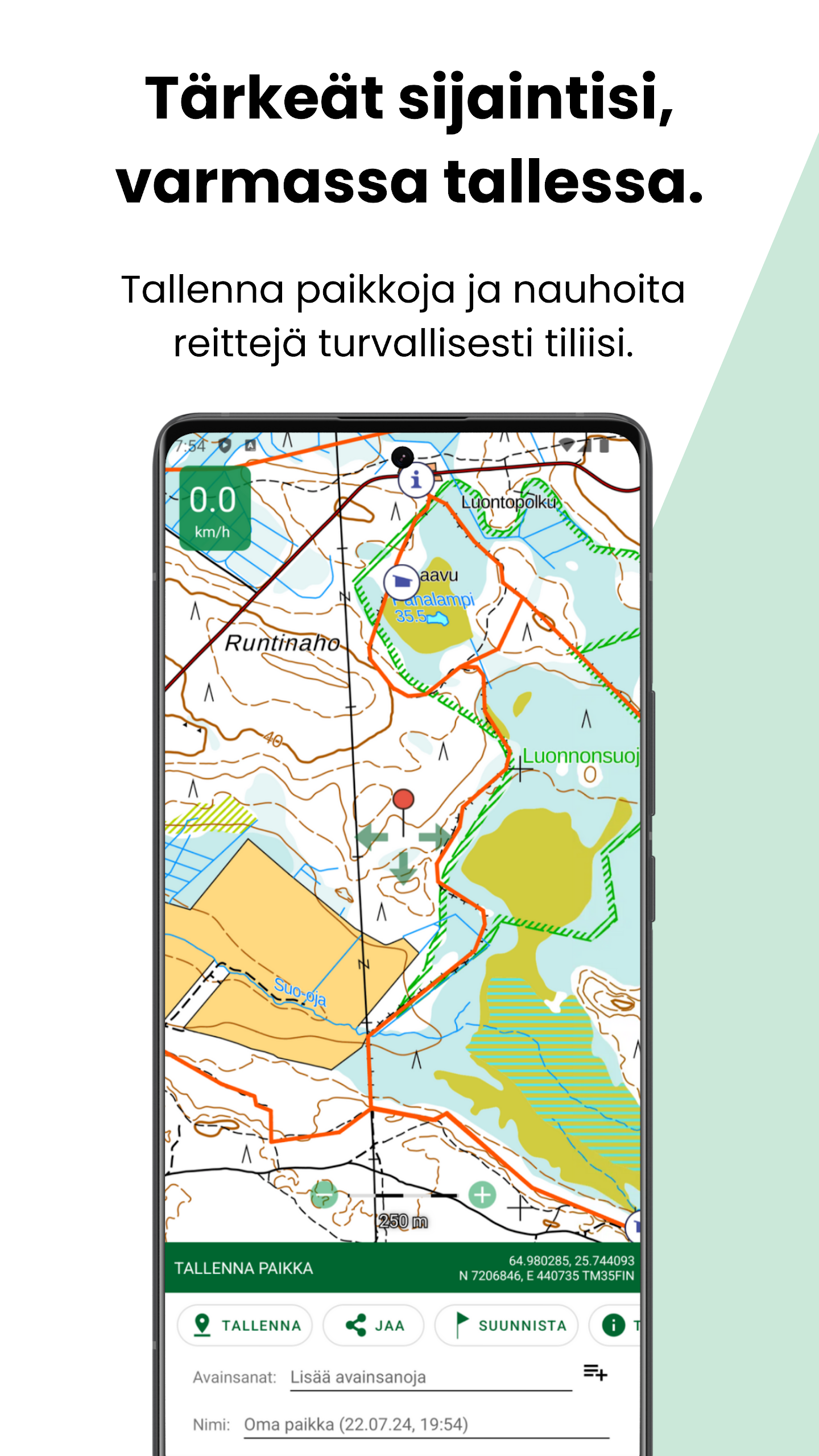
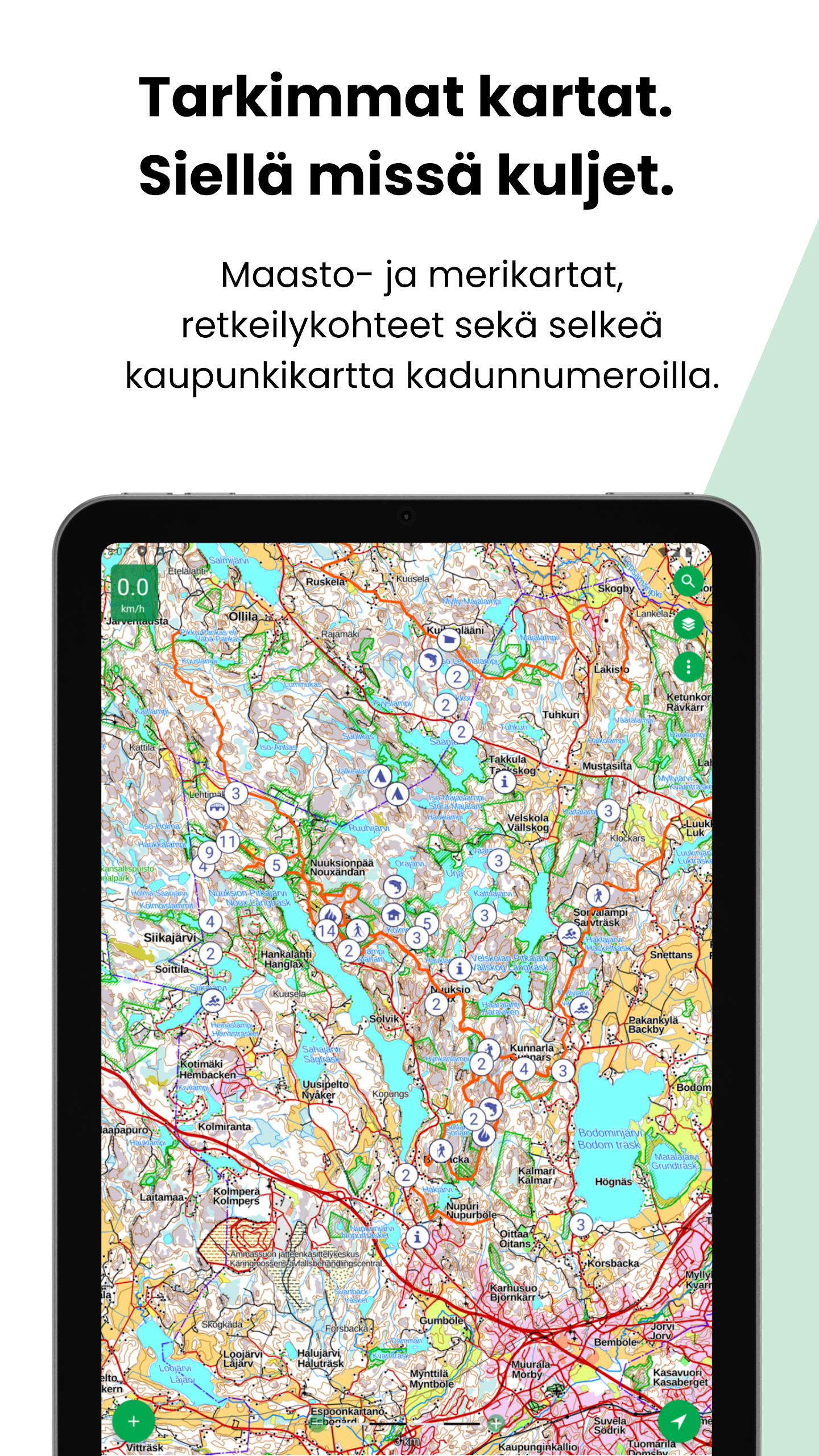
Karttaselain provides the essentials for navigating and analysing land and water. The free map set includes accurate topographic maps, aerial images, and urban maps with street names. Basic depth charts show contours and readings for smaller lakes, and a basic property map shows boundaries and codes from the property register. The app displays GPS location, tracking and speed, supports map rotation to direction of travel and a compass view, and offers directional lines and distance-to-target tools where device sensors allow. Users can save and organise places and routes, import and export GPX files, open locations from other apps and submit map feedback developed in cooperation with the National Land Survey.
Key Features
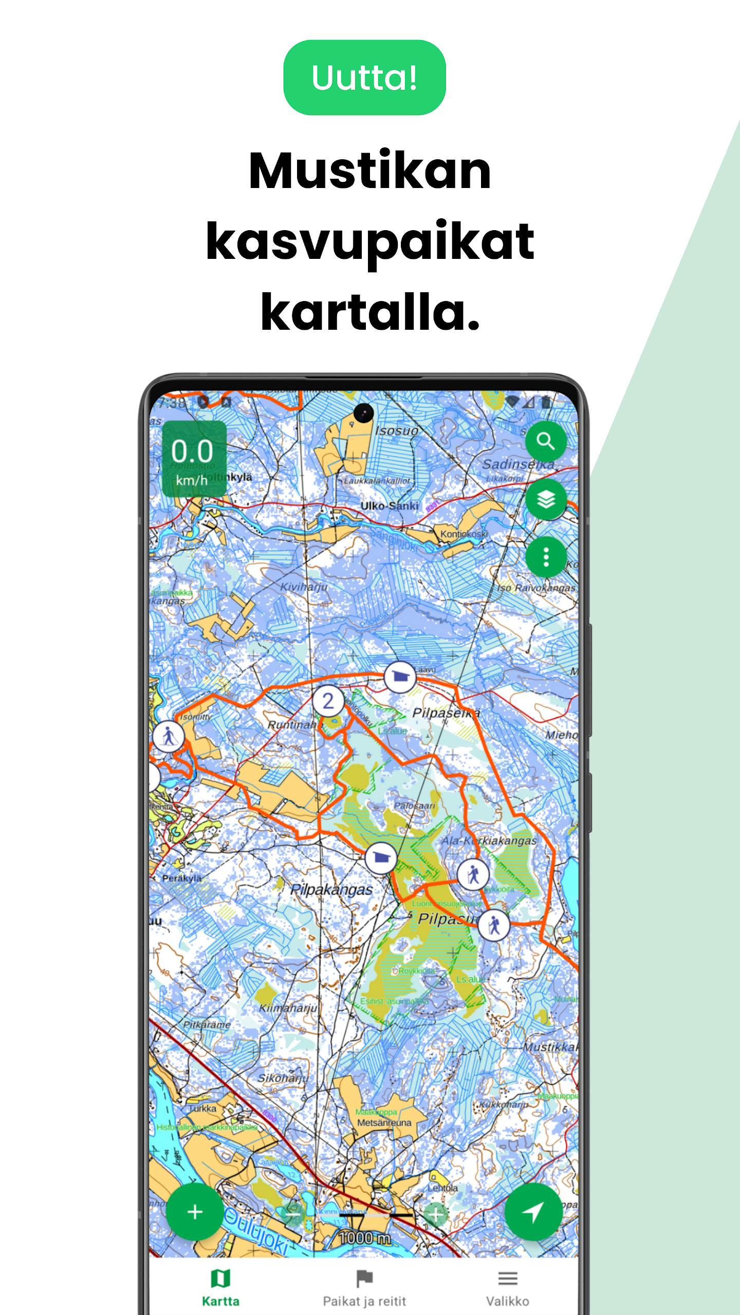
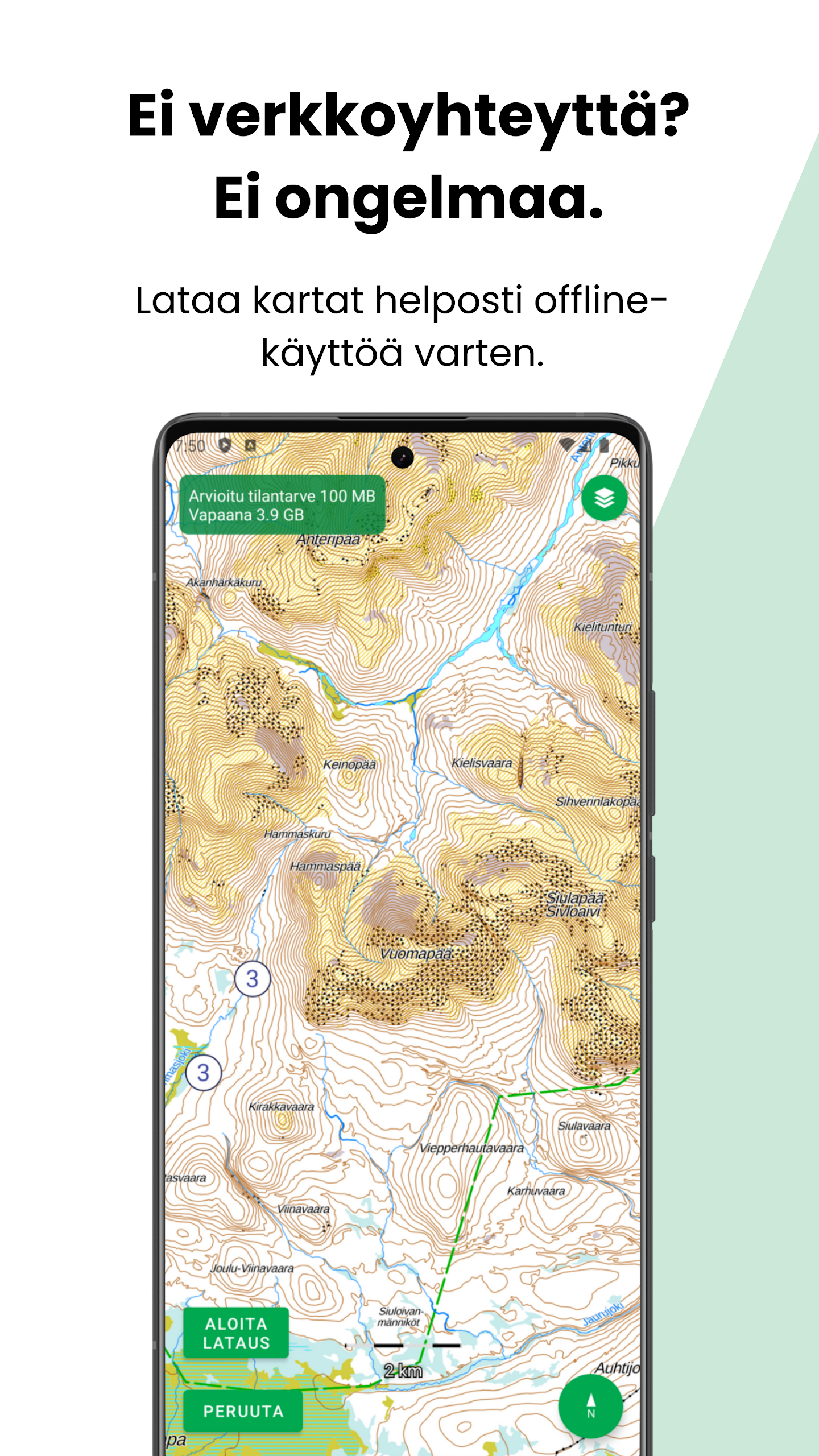
Upgrading to Karttaselain Plus expands the map data and productivity tools: most comprehensive marine charts and depth contours for boating and fishing, continuously updated property boundaries and searchable property areas, hillshade and forest orthophotos for richer terrain context, and secure cloud storage for waypoints and routes. Plus also enables automatic synchronization between web and mobile, route planning and area calculations for drawn regions, convenient offline map downloads, support for tracking devices and dog GPS, and the ability to add and browse hunting areas. A 14-day free trial is available; subscription options after the trial include €9.99 for two months or €39.99 for twelve months, with single-user access across up to four devices and multi-user business licence options.
User Experience
The interface keeps navigation-focused tools within easy reach: map layers and the new slope shading and forest orthophoto options are accessible via the map menu once a Plus subscription or trial is active. Offline downloads and smooth GPS tracking make the app dependable on trails and on water, while GPX import/export and keyword-managed saved places simplify trip preparation. Map feedback channels and an active user community help keep the data current, and customer support is available to help with setup and subscription questions.
Conclusion
Karttaselain is a practical choice for anyone who needs authoritative mapping and reliable offline navigation across Finland and neighbouring terrain. With solid free features for everyday use and a feature-rich Plus tier for boaters, land managers and frequent outdoors users, Karttaselain offers a clear upgrade path and a risk-free trial to explore its full capabilities.
- No virus
- No advertising
- User protection
Information
- File size: 46.20 M
- Language: English
- Latest Version: 2.6.53
- Requirements: Android
- Votes: 275
- Package ID: com.accelbit.karttaselain
- Developer: AccelBit Oy
Screenshots


Explore More
Streamline operations and maximize productivity with our innovative business apps. Manage contacts, schedule meetings, and route calls seamlessly. Collaborate on documents and projects in real-time. Track inventory, finances, and analytics to inform smart decisions. Build customized proposals, invoices, and contracts to win clients. Stay on top of emails, tasks, and passwords for efficient work.
Time Sphere

Terra Nativa

Nail Studio Manager

OneLC Action Line

Pingmate.app - Chat Automation

AIMZ

Mazurka Suite

DOUKIスマート