Introduction
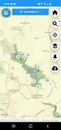
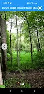
WSSC WATERshed is a practical mobile tool for exploring recreational areas around two reservoirs in Montgomery, Prince George's, and Howard counties. The WSSC WATERshed app combines maps, trail and amenity information, and simple reporting tools so anglers, hikers, bird watchers, boaters and families planning a picnic can find what they need before they go. With offline maps and precise location support, WSSC WATERshed helps users navigate low-service areas and select trails, access points and facilities with confidence.
Key Features
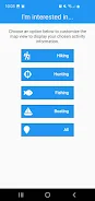
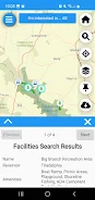
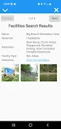
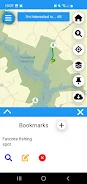
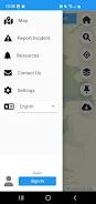
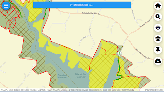
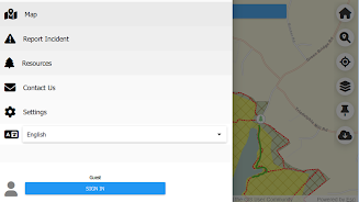
Step-by-step instructions explain how to use the app and its key tools. Current location display and an offline map option support navigation when cell service is weak. The app locates nearby amenities such as fishing areas, restrooms, picnic sites, playgrounds and boat launches. Trail maps include descriptions of terrain to help plan hikes and rides. Water depth information helps anglers identify productive spots more efficiently. On-site reporting lets users report unattended boats, vandalism or other concerns and there is an option to sign up for watershed updates and closure notices.
Advantages
WSSC WATERshed consolidates maps, trail data and amenity locations into a single, easy-to-use interface. Offline map support keeps navigation reliable in areas with poor cell coverage. Detailed trail descriptions and water depth information make the app useful for both hikers and anglers. Built-in reporting tools enable visitors to flag maintenance needs or safety concerns quickly. Optional sign-up for updates helps users stay informed about closures or important watershed notices.
Limitations
The app's coverage focuses on the two reservoir watersheds, so it has limited usefulness outside those areas. Location accuracy depends on the device GPS and battery life, which can affect tracking and navigation. Some interactive features and timely updates may require occasional internet connectivity to function fully.
- No virus
- No advertising
- User protection
Information
- File size: 120.16 M
- Language: English
- Latest Version: 1.0.8
- Requirements: Android
- Votes: 399
- Package ID: com.wsscwater.wsscwatershed
- Developer: WSSC Water
Screenshots


Explore More
Equip yourself with our all-in-one toolbox app for everyday tasks and projects. Instantly convert between units, calculate tips, scan documents, manage files, and more with handy productivity tools. Includes a level, compass, QR code reader, ruler, speedometer, decibel meter, and flashlight. Save frequently used tools to your customizable dashboard for one-tap access. Track billable hours, wages, budgets, and invoices. Annotate screenshots, magnify labels, and sign PDFs on the go.

Chess Combinations Vol. 1

Xvideos

Action

Remix

Kella AI: Plan, Shop, Cook

FlickFocus: Movies & TV

WordFinder

Ebru