Introduction
Avia Maps Aeronautical Charts is an essential app for pilots and aerospace enthusiasts all over the world. Whether you're planning a flight or navigating in the air, this app has got you covered. With just a few taps, you can download the necessary data for any 5 by 5 degree area on Earth, making it available offline at all times. The app includes a vast database of over 65,000 airports, 9,000 navaids, and 15,000 waypoints, as well as airspace information for 62 countries. But that's not all - Avia Maps also provides high-resolution weather forecasts, so you can stay updated on cloud cover, precipitation, and wind both on the ground and aloft. The app even allows you to check the forecast during flight, even without cell reception. To ensure your safety, Avia Maps can display traffic information from your favorite ADS-B receiver or the SafeSky app, giving you complete situational awareness. The app also offers multiple aircraft profiles for accurate performance calculations, as well as the ability to synchronize routes, aircraft profiles, and user waypoints across multiple devices.
Features of Avia Maps Aeronautical Charts:
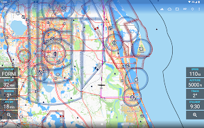
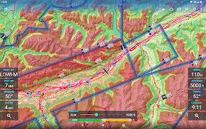
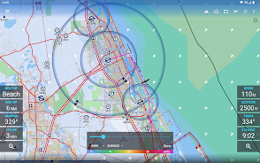
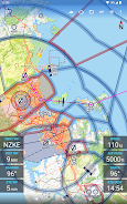
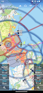
> Offline map download: Users can choose any 5 by 5 degree area on earth and download relevant data for offline use, allowing for seamless pre-flight planning and in-flight navigation.
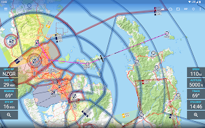
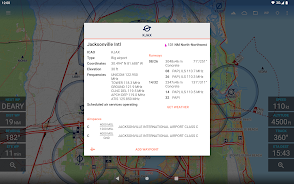
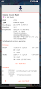
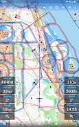
> Extensive aviation database: The app features over 65000 airports, 9000 navaids, and 15000 waypoints around the globe, providing comprehensive information for pilots and aerospace enthusiasts.
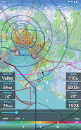
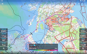
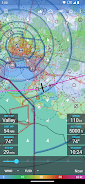
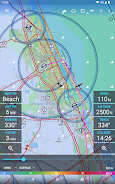
> Global weather forecasts: Users can access high-resolution weather forecasts from reputable sources such as the German DWD and US American NOAA. The accurate map layers include cloud cover, ceiling, precipitation, and ground and aloft winds.
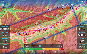
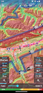
> Terrain overlay: A digital elevation model dynamically colors hills and mountains on the map based on the user's current altitude, increasing situational awareness during flight.
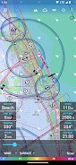
> Traffic information integration: Avia Maps can display traffic information from ADS-B receivers or the SafeSky app directly on the map, enhancing safety for pilots. It supports the GDL90 format used by most portable ADS-B receivers.
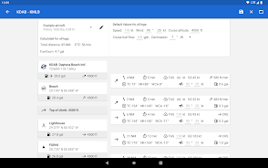
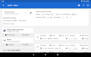
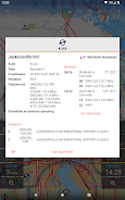
> Customizable aircraft profiles: Users can create multiple aircraft profiles, inputting climb performance, fuel consumption, engine type, and more. The app uses these profiles for accurate route calculations, considering various factors to optimize performance.
Conclusion:
Avia Maps Aeronautical Charts is a reliable and user-friendly app designed for pilots and aerospace enthusiasts. It offers offline map download, an extensive aviation database, global weather forecasts, terrain overlay, traffic information integration, and customizable aircraft profiles. With its comprehensive features and intuitive design, Avia Maps is a must-have app for those seeking accurate and efficient flight planning and navigation. Download now to experience its full capabilities during the 30-day trial period, and purchase a perpetual license or subscribe to the professional tier for continued access to all features.
- No virus
- No advertising
- User protection
Information
- File size: 38.49 M
- Language: English
- Latest Version: 3.12.2
- Requirements: Android
- Votes: 421
- Package ID: com.mytowntonight.aviamap
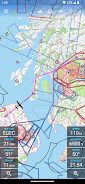
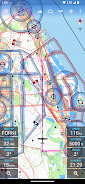
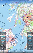
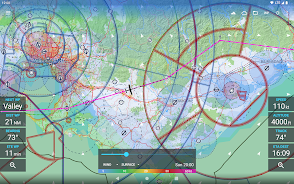
Screenshots


Explore More
Be prepared and plan your days better with our new weather app. Get real-time hyperlocal forecasts, customizable alerts and widgets, and detailed hourly projections. Beautiful photo backgrounds change dynamically based on conditions. Intuitive radar and satellite imagery help you visualize storms and patterns. Get humidity, precipitation probability, pollen count, and other useful data at a glance. Save favorite locations like home, work, or travel destinations for quick access.

skateable

WITAL

Nature Path Guide

Park Ranger

Not a Clock: Aesthetic Widgets

Melvine

Glassify - Widgets & Themes

Active Husky