Introduction
Embark on your next outdoor adventure with ease and confidence using Whympr : Mountain and Outdoor that is your ultimate mountain and outdoor companion. With over 350,000 routes worldwide sourced from top platforms and the ability to filter based on activity and difficulty level, you can find the perfect adventure tailored to your preferences. Create and save tracks, access topographic maps, view routes in 3D, check avalanche reports, and even share your experiences with a community of like-minded enthusiasts. Stay prepared with weather forecasts, peak identification, and sensitive zone filters to contribute to environmental preservation. Download the free base app and upgrade to the Premium version for an enhanced experience.
Features of Whympr : Mountain and Outdoor:
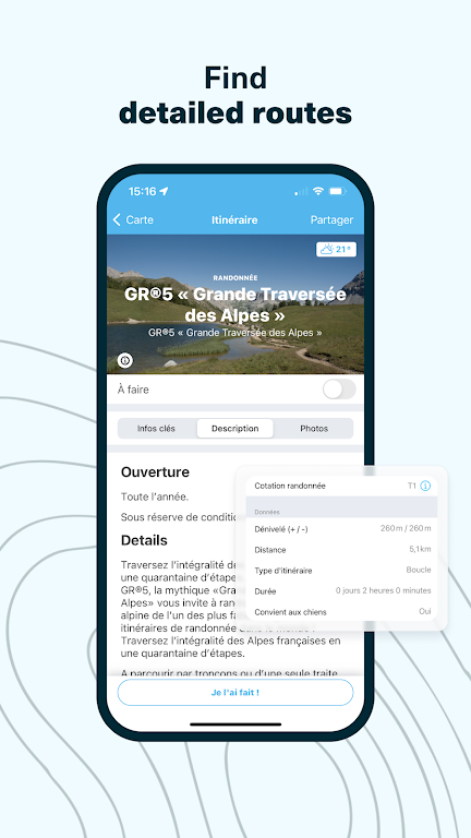
❤ **Wide Range of Routes**: Whympr offers access to over 350,000 routes worldwide, sourced from popular platforms like Skitour and Camptocamp, allowing you to explore new horizons and find the perfect adventure for you.
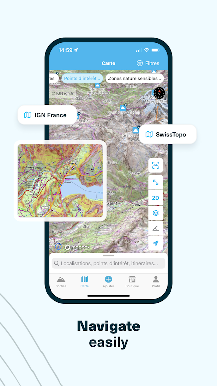
❤ **Topographic Maps**: With Whympr, you can access a collection of topographic maps, including IGN, SwissTopo, and USGS, as well as the Whympr outdoor map covering the world, helping you to visualize slope inclinations for thorough preparation.
❤ **Community Interaction**: Join a community of over 200,000 users who share their outings, helping you stay updated on recent terrain conditions, avalanche reports, and fresh conditions in the mountains.
❤ **Premium Features**: By subscribing to the Premium version of Whympr, you can enjoy exclusive features such as offline mode, advanced route filter, detailed weather conditions, GPS track recording, and much more for a complete outdoor experience.
Tips for Users:
❤ **Use Filters**: Utilize the filters in Whympr to choose routes based on your preferred activity, difficulty level, and points of interest to personalize your outdoor experience.
❤ **Download Routes**: Download routes for offline viewing, allowing you to access them even in remote locations where internet connection may be limited.
❤ **Stay Updated**: Check daily updated avalanche reports, mountain weather forecasts, and recent terrain conditions shared by the community to ensure a safe and enjoyable outdoor adventure.
❤ **Utilize Premium Features**: Make full use of the Premium features offered by Whympr, including topographic maps, GPS track recording, and track creation with elevation and distance calculation, for an enhanced outdoor experience.
Conclusion:
With a wide range of routes, topographic maps, community interaction, and premium features, Whympr offers everything you need to make the most of your outdoor experiences. By utilizing filters, downloading routes for offline use, staying updated on conditions, and exploring premium features, you can enhance your outdoor adventures and create unforgettable memories. Download Whympr : Mountain and Outdoor today and embark on your next mountain adventure with confidence.
- No virus
- No advertising
- User protection
Information
- File size: 51.42 M
- Language: English
- Latest Version: 2.14.0
- Requirements: Android
- Votes: 297
- Package ID: com.whympr.w
- Developer: Whympr
Screenshots
Explore More
Be prepared and plan your days better with our new weather app. Get real-time hyperlocal forecasts, customizable alerts and widgets, and detailed hourly projections. Beautiful photo backgrounds change dynamically based on conditions. Intuitive radar and satellite imagery help you visualize storms and patterns. Get humidity, precipitation probability, pollen count, and other useful data at a glance. Save favorite locations like home, work, or travel destinations for quick access.

RailTrip (PasseGares)

Launcher OS Pro

Crossbar

Launcher OS™

Air Navigation Pro

New Orleans News from WWL

WHIO Weather

Live Weather Radar Launcher
You May Also Like
Comment
-
Superbe trouvaille ! l'application est intuitive et complète. Pleins de nouvelles idées de sorties randonnées, hâte de les explorer !2024-09-28 05:32:42
-
Cool2024-09-27 07:00:15
-
Super utile pour mes randos2024-09-26 17:42:37
-
J'adore !!!2024-09-26 14:53:52
-
J'aimerai supprimer mes données et mon compte sauf que c'est impossible, aucun mail, aucun lien de suppression...pas très RGPD...2024-09-26 11:05:01
-
Awesome2024-09-25 13:00:11


