
Introduction
GPS Map Camera Photo Timestamp is an Android utility that stamps photos with accurate time, date and location data directly from your device camera. It lets users document fieldwork, travel, inspections or real estate listings by embedding GPS coordinates and customized textual overlays onto images in a simple, reliable workflow.
What the app does
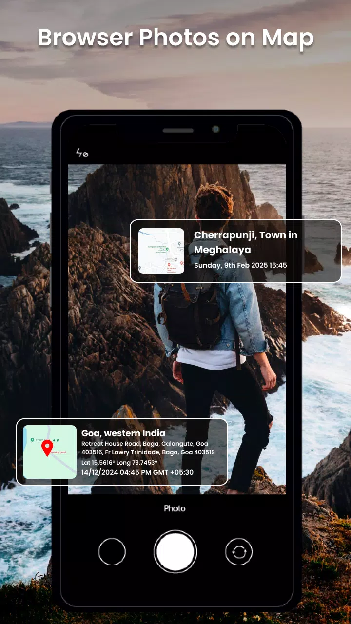
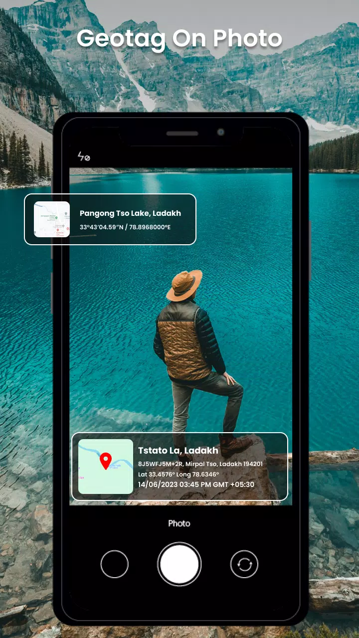
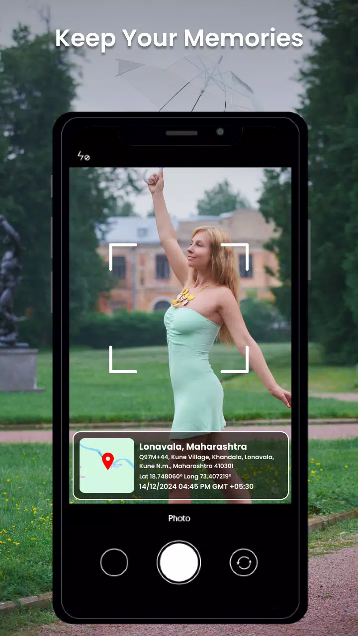
At its core, GPS Map Camera Photo Timestamp captures photographs and imprints metadata visually onto the image surface. That includes a readable timestamp, GPS latitude and longitude, altitude, map references and optional custom notes such as site names or project IDs. The app can use live GPS and device clock, or accept manual adjustments when precise positioning is required.
User interface and workflow
The interface is designed for fast field use: a clear viewfinder, large capture button, and immediate preview with overlay controls. Users choose overlay templates before snapping a photo or apply settings in batch to existing images. Presets allow switching between different stamp formats—compact, detailed, or minimalist—so teams can standardize visuals across reports.
Key features
GPS Map Camera Photo Timestamp offers a collection of practical tools that support professional documentation:
- Customizable stamps: Edit font size, color, background opacity and position to match branding or readability needs.
- Accurate GPS embedding: Use device satellites or network data to capture coordinates and altitude, with visible accuracy indicators.
- Multiple templates: Save different stamp layouts for inspections, property surveys, or travel logs.
- Batch processing: Apply stamps to many photos at once, saving time when handling large image sets.
- Offline mode: Add timestamps and coordinate prints even when network access is limited; GPS still functions where satellite lock is available.
Practical uses
This app is useful for professionals who require trustworthy visual records. Construction supervisors can timestamp site photos for progress tracking, insurance agents can document damages with location and time, and real estate agents can attach proof-of-visit data to property images. Travelers and outdoor enthusiasts will also appreciate the ability to preserve exact coordinates of scenic viewpoints.
Customization and templates
Customization is central to the experience. GPS Map Camera Photo Timestamp provides drag-and-drop placement for text blocks and map snippets, plus multiple font choices and color pickers to ensure stamped information is legible on any background. Users can create and export templates so that teams across different devices maintain consistent presentation standards.
Performance and compatibility
The app is optimized for Android devices and performs well on a wide range of hardware. It handles high-resolution images without significant lag and includes settings to control output size for quicker sharing. GPS acquisition is tuned to balance speed and precision, and the app reports estimated accuracy so users know how reliable the coordinates are.
Privacy and data handling
GPS Map Camera Photo Timestamp keeps user privacy in mind: location stamps are embedded into image pixels rather than altering original EXIF data unless the user explicitly chooses to update metadata. That approach gives a visible record without automatically exposing hidden information. Options allow users to remove or anonymize coordinates before exporting.
Integration and export options
Exporting supports common image formats and direct sharing to email or cloud services. Built-in tools let you attach notes or generate CSV logs of timestamps and GPS data for easy import into reporting systems. The app plays well with workflow apps used in field operations, making it straightforward to include stamped images in official documentation.
Getting started
To begin, install the app, grant camera and location permissions, select a stamp template, and take a test photo to confirm layout and accuracy. Adjust text and map elements, save a template, and then use batch mode when processing existing photo collections. Regularly calibrate location settings by ensuring good GPS reception for the most accurate stamps.
- No virus
- No advertising
- User protection
Information
- File size: 10.60 M
- Language: English
- Latest Version: 1.1
- Requirements: Android
- Votes: 120
- Package ID: com.gpsmapcamera.live.geolocation.photocamera
- Developer: Bryant Digital Technologies
Screenshots
















Explore More
Empower learning and research with our innovative reference apps. Access dictionaries, thesauruses, encyclopedias, and more with our comprehensive databases. Get homework help, study tips, and writing guides from our academic resources. Learn new skills by browsing how-to videos and manuals. Stay up-to-date with latest news, data, and facts curated by our editors.

MsBook.Pro- Cărti electronice

CSS3

TownSq Community

Tronsmart

Chatbot - AI Image Generator

69ers

kaiian driver

Airble