

Introduction
LitterTrace is a mobile app that helps users identify, report, and map litter hotspots using geotagged photos and simple reporting tools. It combines location-based mapping, community reporting, and analytics to help local groups and councils prioritize clean-up efforts and track improvements over time.
Core features that streamline clean-up
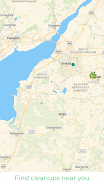
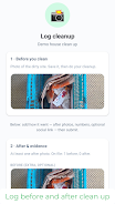
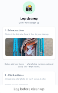
LitterTrace provides practical tools for capturing and organizing litter data in the field. The app lets volunteers or staff record the type of waste, attach a timestamped photo, and tag the exact location with GPS. Saved reports populate a shared map so teams can see concentrations, repeat offenders, and areas needing immediate attention.
- Quick reporting: one-tap photo capture and category selection for fast submissions.
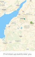
- Geotagged mapping: automatic location pins to visualize where litter accumulates.
- Custom categories: tailor tags for common local items like plastics, bulky waste, or hazardous materials.
- Offline mode: collect data without signal and sync later when connected.
How the system organizes data
The app organizes each submission into an accessible database that supports filtering and bulk export. Administrators can flag high-priority sites, assign clean-up tasks, and monitor progress with simple dashboards. LitterTrace converts field observations into actionable lists so teams can plan routes, allocate resources, and measure outcomes more efficiently than manual spreadsheets.
Mapping and analytics for informed decisions
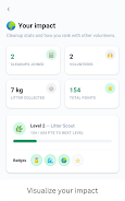
Mapping is central to the app experience. Heatmaps show persistent problem areas while timeline views reveal how conditions change after interventions. Built-in analytics provide counts by category, frequency by location, and trending patterns across weeks or months. These insights help local authorities and NGOs target prevention campaigns and evaluate the impact of community clean-ups.
Collaboration and community engagement
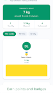
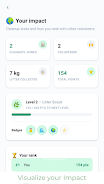
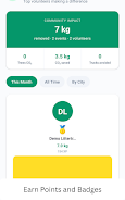
LitterTrace supports collaborative workflows to bring volunteers, city staff, and environmental groups together. Shared maps and task lists keep everyone aligned, and users can leave notes on individual reports to document follow-up actions. Community features encourage local stewardship by highlighting volunteer contributions and enabling simple achievement badges for active participants.
- Team workspaces: invite members, assign roles, and manage permissions.
- Commenting: add context or safety notes to specific reports.
- Export tools: CSV and PDF exports help you share results with stakeholders.
Interface and workflow
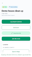
The interface prioritizes speed and clarity. A minimal report screen reduces distractions so users can capture incidents quickly. Map layers and filters are accessible with clear icons, and administrative menus centralize management tasks. The workflow supports rapid triage: find a hotspot, attach evidence, assign a clean-up, and mark the task complete when done.
Performance and compatibility
LitterTrace is designed for use on a variety of Android devices and remains responsive even on older phones. Data synchronization is optimized to minimize bandwidth use, and offline caching keeps field teams productive in low-coverage areas. The app integrates with common mapping services and can export standardized datasets for municipal systems or research purposes.
Getting started quickly
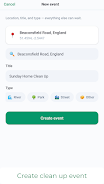
New users can download the app, create an account, and start reporting within minutes. Administrators can set up a team workspace and invite volunteers via email or invite links. Training takes minimal time because the capture and mapping steps are intuitive; community groups often run short onboarding sessions to demonstrate best practices for categorizing waste and ensuring safety during clean-ups.
LitterTrace makes local litter management more measurable and collaborative by turning individual observations into mapped datasets and follow-up actions. With clear reporting tools, mapping, and team features, the app supports smarter planning for cleaner streets and waterways while keeping volunteer coordination simple and effective.
- No virus
- No advertising
- User protection
Information
- File size: 98.81 M
- Language: English
- Latest Version: 1.3.1
- Requirements: Android
- Votes: 301
- Package ID: com.littertrace.app
- Developer: Obinna Obianuo
Screenshots
















Explore More
Equip yourself with our all-in-one toolbox app for everyday tasks and projects. Instantly convert between units, calculate tips, scan documents, manage files, and more with handy productivity tools. Includes a level, compass, QR code reader, ruler, speedometer, decibel meter, and flashlight. Save frequently used tools to your customizable dashboard for one-tap access. Track billable hours, wages, budgets, and invoices. Annotate screenshots, magnify labels, and sign PDFs on the go.

Jacob Andre
Что по району-Где реально норм

Chord Scale Studio

Alpha Gym Club
Kiolix Pulse - Global Trends

Concrete & Gravel Calc

S-Trader journal יומן מסחר

Cigar Ledger